Sutlej River – The Longest Tributary of the Indus
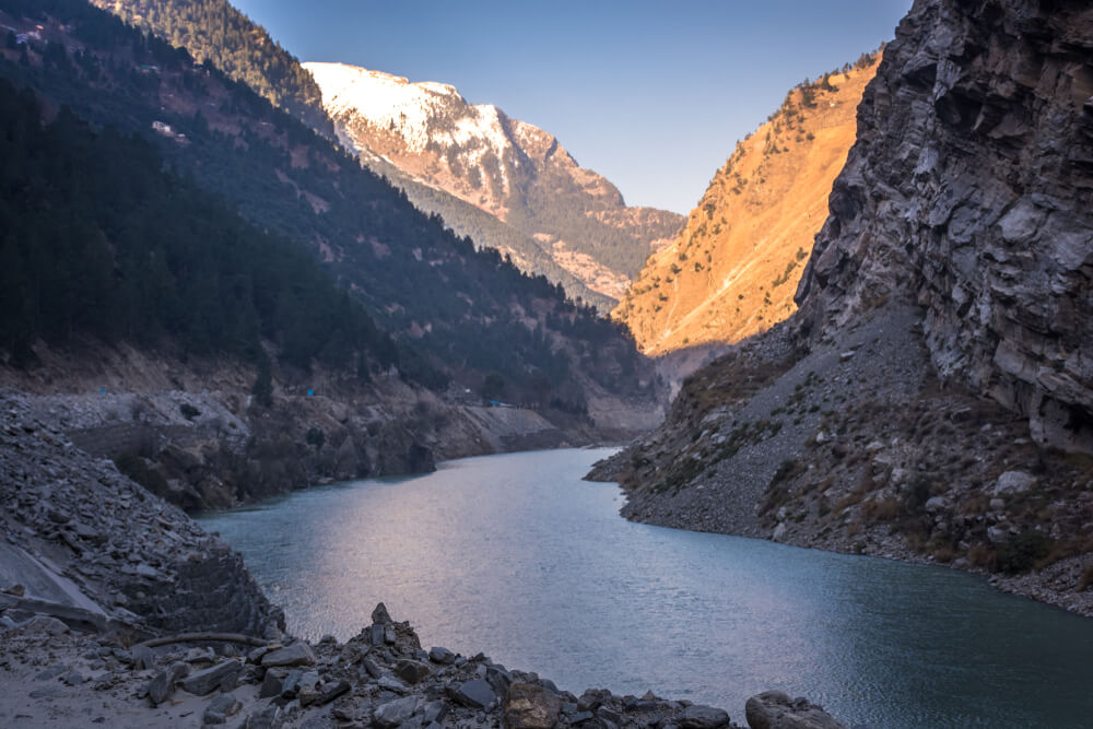
River Sutlej is one of the most important rivers of Pakistan that helps keep India and Pakistan alive and fertile. Ancient Greeks used to call it Zaradros, and you will find it as Shutudri in Sanskrit. The Sutlej River is one of the Indus tributaries that merge with four others to give Punjab its name, which means five rivers, the Sutlej River origins in the Himalayas on the northern slope in South Western Tibet. Lake La’nga is located at an elevation of about 4600 meters. The river enters the Indian region of Himachal Pradesh as it flows west-southwestward through Himalayan gorges. From here, it enters the plains of Punjab near Nangal. As it continues towards the southwest, it is joined by the river Beas. These merged rivers flow for more than 100km at the Pakistan-India border before finally entering Pakistan. The Sutlej River flows about 220 miles before joining the Chenab River near Bahawalpur. These rivers eventually form the Panjnad that flows into river Indus, ending at the Arabian Sea.
History / Background
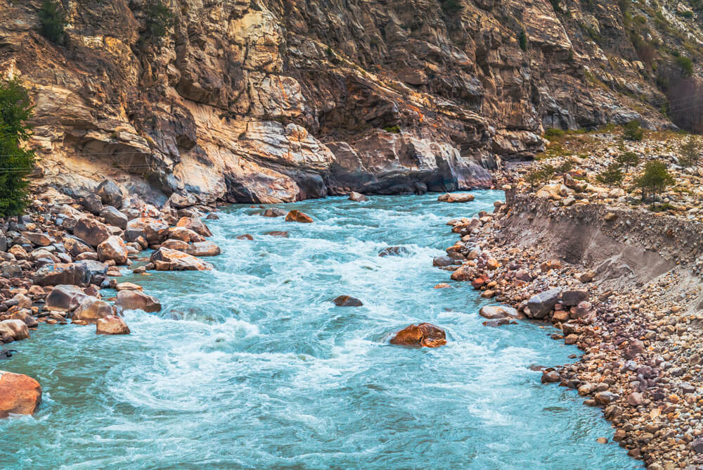
The Sutlej has been around since ancient times. The monsoon rains and snowmelt in the spring and summertime control the water flow and hydrology. Heavy rains during the monsoon season between June and August cause expensive downstream flooding. Maximum flood release was recorded in 1955 when the river flowed at about 17000 cubic meters per second.
During the winter season, the water flow of River Sutlej is substantially decreased because of little or no precipitation and no meltwater from Himalayan glaciers.
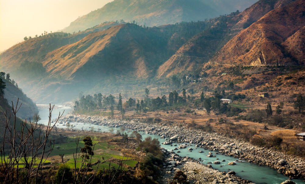
About 1400 km of the river, Sutlej is used for irrigation and farming. Since the river Sutlej is equally important to Pakistan and India, there was a significant water dispute in the late 1950s. The Indus water treaty was finally signed by both countries, concluding that the water rights of river Sutlej were awarded to India. In contrast, the country was forbidden to store or block the water of the river Indus as it was awarded to Pakistan.
Geography
Back in time, the valley through which the Sutlej water passed was known as the Garuda Valley. It is situated only a few miles from the Himalayan ranges. At that time, the river was also called the Zaradros River, which was also the primary mode of transportation for locals and the royals.
Timber firewood was transported to villages like Hamir, Pur, and Bilas. In many ancient religions, the river was considered a god, but after the invasion of the Subcontinent by the Muslims, it was called Ja –e –ilm, which means the place of knowledge.
What is the Length of the Sutlej River?
The Sutlej River is 20,000 feet (at its origin) above the average sea level. The Sutlej is the Indus River’s easternmost tributary, with a combined length of the Satluj River equalling 1450 km, 529 km of which is in Pakistan.
Where Does the Sutlej River End?
The Sutlej River joins the Chenab River about 17 kilometers (11 miles) north of Uch Sharif, forming the Panjnad River, which eventually runs into the Indus River about 100 kilometers (62 miles) west of Bahawalpur. The river concludes at Port bin Qasim and falls into the Arabian Sea.
Is Sutlej Tributary of the Indus?
Sutlej is the most extensive of the Indus River’s five tributaries. It travels through Himachal Pradesh before entering the Indian region of Punjab. Before stepping into Pakistan and joining the Indus, it acquires the Beas River. Apart from the Beas, the Sutlej is India’s only river that passes through East Punjab.
Headworks on Sutlej River in Pakistan
Two main headworks on the Sutlej River in Pakistan are the Islam Headwork and Sulemanki Headworks. However, the Dams on the Satluj River primarily exist in India.
Islam Headwork
These headworks are a diversion point for the Sutlej River. The Islam headwork is also commonly called Head Islam. It is located on the river Sutlej at Hasilpur in Punjab. It is the central unit for controlling floods and providing irrigation water to the farmers. It is about 15km north of Hasilpur and 8 km on the Vehari- Hasilpur road. Islam Head is designed to discharge 8500 cubic meters of water per second. It irrigates about 278,800 hectares of land around Bahawalpur. Three canals rise from Mailsi Canal, Bahawal Canal, and Qaim Canal.
Sulemanki Headwork
Sulemanki Headwork is another one on the Sutlej River near Okara in Punjab. The headwork was also a part of the Sutlej Valley Project. It was built by the British government in collaboration with the Nawab of Bahawalpur in 1926. The irrigation scheme was introduced to develop the bear by areas by providing fresh water for domestic and agricultural use.
The headwork is located about a mile from the Indo-Pak border. Three canals rise from this headwork and irrigate the neighboring area of southern Punjab. It also waters the Bahawalpur district of the province. One of the canals, Eastern Sadiqia, runs on the India-Pakistan border. It is a waterway and a prominent strategic landmark for Pakistan. In Indian intrusion, the canal will serve as a central defensive position.
Head Syphon Bahawalpur
Another vast and historic landmark on the Sutlej River is the Head Syphon of Bahawalpur. The actual name of this landmark is Mailsi Syphon. It is the point where the SMB link canal passes under the river Sutlej. Mailsi Syphon is a remarkable engineering project which allows about 6000 cusec water to pass under the river bed of Sutlej. It was a part of the Indus Basin Settlement Plan.
Bridges on Sutlej River
Many small and large bridges are on the river Sutlej after it enters Pakistan. The most popular of all these bridges is the railway bridge built in 1826 during the rule of Nawab Bahawal Khan III. It is an architectural wonder with long iron bars joined by hundreds of laborers. Back then, there was only one route on the bridge, so only one train could pass at a time. In 1926, the upgradation and renovation of the bridge were carried out to build 2 tracks to make a strong connection between Upper Punjab and Sindh.
Famous Tourist Spot on Sutlej River Pakistan
Many popular touristy places are on the Sutlej River after it enters Pakistan. However, the most popular one is the princely state of Bahawalpur, a beautiful city on the river Sutlej’s bank. The city has a desert, lush green gardens, and massive historic palaces that will surely not fail to impress you.
You can enjoy boating and other such water sports on various points at river Sutlej.
Importance of Sutlej River
The Sutlej River is of prime importance for both India and Pakistan. The Sutlej River enters India and flows west and south-westwards into the Shipki La Pass in Himachal Pradesh. Here the altitude is 6608 meters. The river’s main route runs north of the Vindhya ranges, east of Pakistan’s central Makran range. It lies south of the Hindukush ranges before merging with the Chenab River.
Before merging with Beas, the river enters Punjab near Nangal. It flows for another 350 km and combines with Chenab.
Even though the water of Sutlej is allocated to India, it is still quite important for Pakistan as numerous irrigation canals are built to offer ample water for the farmers to grow crops. This successful canal system and extensive farming are impossible without access to Sutlej water. Moreover, the healthy amount of water in the river Sutlej is also important for the environment and for reducing ever-booming global warming.
Interesting Facts about the Sutlej River
Here are some interesting facts about river Sutlej.
- · The Sutlej River was known as Zaradros in Ancient Greek, Shutudri in Sanskrit,
- · Many religions considered the river to be a god.
- · It is the longest of the five Indus River tributaries that give the Punjab its name (meaning “Five Rivers”).
FAQs
Which river is called the backbone of Punjab?
Five rivers cross the border between India and Pakistan in the northern part of the country, the longest of which is the Sutlej. The Bhakra Nangal Dam is being built around the Sutlej River to provide irrigation to Rajasthan, Haryana, and Punjab. So it is called the backbone of Indian Punjab.
How deep is the Sutlej River?
Satluj’s flow, primarily from snow and glaciers, has carved a valley 914 meters deep through these deposits. The river then flows through the Indian states of Himachal Pradesh and Punjab.
From where does the Sutlej River originate?
Sutlej River is the longest of the five Indus River tributaries that give the Punjab its name (meaning “Five Rivers”). It rises above 15,000 feet (4,600 meters) on the Himalayas in Lake La’nga in southwestern Tibet. Satluj River’s origin is in Tibet.