Jhelum River Pakistan
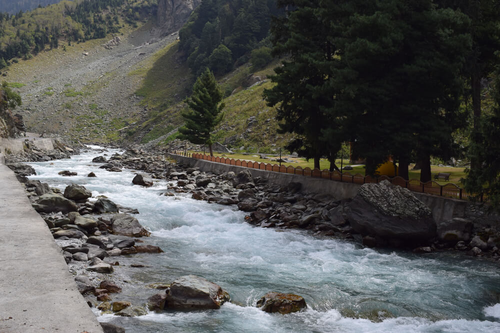
The Jhelum river is the westernmost and the biggest of the five major rivers of Punjab that meet with the Indus River in Pakistan after flowing through the Wular Lake. The river is also one of the tributaries of the vast Indus river. The Jhelum town is situated on the western side of the River and was famous for providing soldiers to the British army before the independence of Pakistan. After independence, Jhelum produced courageous warriors and soldiers who fought for their country. So, Jhelum is also known as the City of soldiers and the Land of Martyrs. Jhelum river is one of the most significant rivers in Pakistan.
Location of Jhelum River
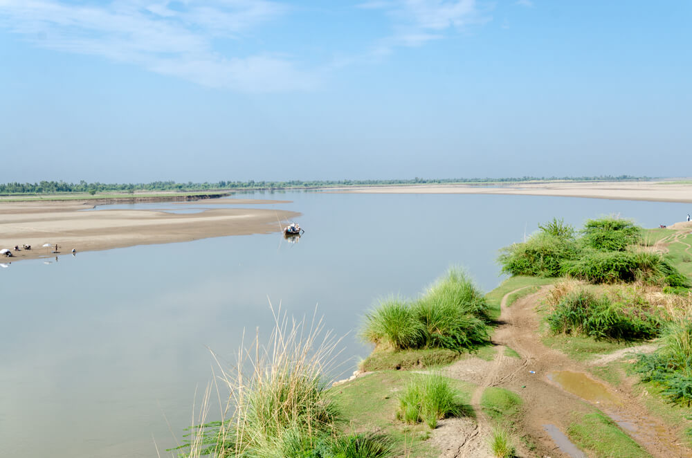
The Jhelum river is in the northern Indian Subcontinent, specifically in the north Punjab Pakistan region. It appears at Verinag and passes through the Indian-governed region of Jammu and Kashmir to the Pakistani-administered part of Kashmir and then into Punjab, Pakistan. Jhelum river is the streamlet of the Chenab river. The length of this River is 725 km.
History
The ancient Greek called River Jhelum Hydaspes. In BC 326, at the battle of Hydaspes river, Alexander the Great and his troops crossed the Jhelum, where he beat the Indian King, Porus. According to Arrian, Alexander the Great built a city from where he began to cross the River Hydaspes, which he entitled Bukhepala to prestige his famous horse Bucephalus, which was buried in Jalalpur Sharif. It is believed that ancient Bukephala was close to the place of Jhelum city.
What is the Jhelum River famous for?
The River Jhelum has a rich capacity for producing hydropower electricity in India. India Basin Project led to the construction of various water control structures, including the Mangla Dam, accomplished in 1967 with a storage capacity of 59,00,000 acre-feet.
When to visit the Jhelum River?
Visiting the Jhelum river requires no specific time; tourists can see it anytime. Only some precautions are necessary during monsoon, as heavy rainfall may increase the water level, which can be dangerous.
Where do the Chenab and Jhelum rivers meet?
The River of Jhelum enters Punjab, Pakistan, in the district of Jhelum. From there, it moves through the plains of Punjab, Pakistan, creating the border between the Jech and Sindh Sagar Doabs. It ends with the convergence with the Chenab River at Trimmu in the district of Jhang.
Geography of River Jhelum
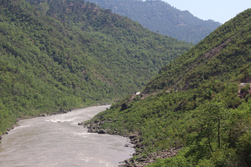
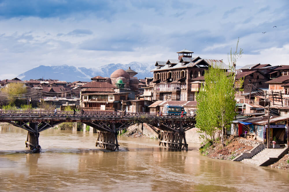
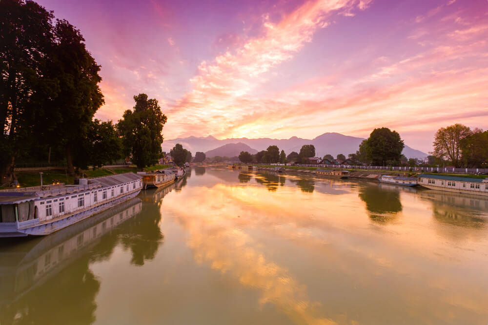
The River Jhelum begins from the Verinag Spring, situated at the bottom of the Pir Panjal in the Southern side of Kashmir valley. The River passes via Wular Lake and Srinagar in Kashmir before it reaches Pakistan through a narrow and deep valley. The Neelam river is the Jhelum River’s main streamlet that meets at Muzaffarabad. The Jhelum River passes through the Kaghan valley and merges with the beautiful River of Kunhar. After Kunhar, it passes through Kashmir’s Kohala bridge and meets the River of Poonch; then it runs to the twelfth largest earth-filled dam named Mangla Dam in Mirpur, then Jhelum River enters the Jhelum district Punjab, and keeps on flowing, establishing a boundary between Sindh Sagar and Chaj Doab. The Jhelum River finally consolidated with the River of Chenab at Trimmu, District of Jhang. Finally, the Chenab River amalgamates with the Sutlej River and forms the Panjnad River, eventually joining the River Indus at Mithankot.
Demography of River Jhelum
The population of Jhelum city was about 188,800 in 2012, and it is the 32nd most significant city in Pakistan about population. The total area of Jhelum city is approx—22 km2 (8.5 sq mi). The density of the population is 261/km. The population majority, 98.47, is Muslim, and other minorities include Christians. The literacy rate of Jhelum city is among the highest in Pakistan at 79 %.
Climatic Condition
The Jhelum is at 32° 56′north Latitude and 73° 44′ east longitude, so the climate of the Jhelum river is humid subtropical and is monsoon-influenced. It is boiling in summer and cold and usually dry in winter.
Tributaries of Jhelum River
River Jhelum has many small and large tributaries which supply water to form a river. They are as follows:
River Lidder
River Lidder is the Jhelum tributary in the Kashmir valley and amalgamates with the River.
River Sind
River Sind is also a tributary of River Jhelum and flows in the Kashmir valley through the Wular lake and combines with the Jhelum river. It is 108 km long.
River Neelam
River Neelam is also one of the most significant tributaries of the Jhelum river and merges with the River in Muzaffarabad.
Kunar River
Kunar river is the tributary of River Jhelum, and it merges with the River after flowing through many rivers, including the Poonch River. After merging with the Jhelum river, it passes through the Chenab and Panjnad, ultimately meeting the Indus river in the Mithankot region.
Tulip Riverside Hotel
Tulip Riverside hotel is located in Chak Nattha, which is 4.1 km from Jhelum. Tulip Riverside hotel is a restaurant that offers accommodation with many other services like free private parking, a shared lounge, a garden, room service, concierge service, and free Wi-Fi throughout the hotel premises.
Jhelum River Dams
The detail of the Dams of the Jhelum river is following.
Mangla Dam
The Mangla Dam is situated on the River Jhelum, about 30 km from Jhelum, the twelfth largest earth-fill dam in the world. Mangla Dam has a storage capacity of 59,00,000 acre-feet. This dam was accomplished in 1967 and had significant importance in Pakistan. The height of the Mangla dam is 482 ft ( 146m), and the length of 10,302ft (3,140m). Mangla dam was constructed primarily to increase the water quantity utilized for irrigation from the Jhelum River and its tributaries. The secondary purpose of the Mangla dam was to produce Hydroelectricity. Moreover, it helped to control the flood by storing water during the monsoon flood-prone period.
Uri Dam
Uri Dam is in the Baramulla district of Jammu and Kashmir with a 480 MW Hydroelectric power station.
Uri Dam II is also located in the Baramulla district of Jammu and Kashmir with a 240 MW Hydroelectric station.
Barrages on Jhelum River
There are two barrages built on River Jhelum, which are detailed below.
Trimmu Barrage
Trimmu Barrage is located downstream of the convergence of the River Jhelum and River Chenab. Trimmu Barrage is located approx. 25 km from Jhang city near Atharan Hazari, the Jhelum River flows into River Chenab. This Trimmu Barrage aims to check and control water flow into the River Chenab for flood control and irrigation purposes. The construction of Trimmu Barrage began between 1937 & 1939 by English engineers and was accomplished on 30 June 2020. It has a maximum discharge capacity of 18,264 cubic meters per second
Rasul Barrage
Rasul Barrage is a barrage located on the River Jhelum between Jhelum district and Mandi Bahauddin District of Punjab, Pakistan. It is located 72 km downstream of Mangla Dam. The existing barrage structure was built in 1968, and its objective is to control water flow in the Jhelum river for irrigation and flood control purposes. The length of this Barrage is 3,201 feet. Rasul Barrage has a discharge capacity of 2,4070 cubic meters per second.
Canals on the Jhelum
There are three canals on the Jhelum River, which are detailed below
The Upper Jhelum Canal
The Upper Jhelum canal begins at the Jhelum river in Mangla dam. It passes through Gujrat and Mandi Bahaudin in Punjab, Pakistan, and ends up in the River of Chenab at Khanki Barrage. The Jhelum canal is an irrigation canal that supplies water to 1.8 acres of farmland.
Jhelum-Chashma Link Canal
Jhelum_Chashma Link Canal has been built, which flows from the Indus River Barrage of Chashma to the Jhelum through Rasool Barrage. Jhelum -Chashma Link Canal’s length is approximately 25 miles (40 km).
Qadirabad – Rasool Link Canal
Qadirabad Rasool Link Canal is another canal excavated from the Barrage of Rasool to Chenab. It is located next to Qila Atar Singh in Punjab, Pakistan. The length of this canal is 47.25 km.
Tourists Spots in Jhelum
Jhelum is an old city but developing daily to keep up with the modern world. Below is the detail of some tourist spots in Jhelum.
Khewra Mines
Khewra mines are situated in the Subdivision Pind Dadan Khan of Jhelum. It is also named Mayo Salt Mine, Canada’s second-largest mine after the Sifto salt mine. It is a famous tourist spot producing Pink Salt, recognized worldwide. Approx 300,000 tourists visit the mine every year. The services of Salt Mine Railways are available for visitors to see the mine. Different models, like a mosque or replica of the Great Wall of China, are built with the help of Salt to attract visitors.
Rohtas Fort
Rohtas Fort is an exceptional architecture of the 16th century, situated near the city of Dina in the Jhelum district of Punjab, Pakistan. It is a remarkable example of the Muslim military architecture of Central and South Asia. Fort Rohtas is one of South Asia’s largest and most visited spots. Afghan Warlord Sher Shah Suri built it. The fort is well known due to its protective walls and enormous gateways. This Rohtas fort was proclaimed a UNESCO World Heritage Site in 1997.
Mangla Dam
The Mangla dam or a water reservoir encircled by Natural beauty and breathtaking scenic views. The calm blue water of the dam attracts tourists, and the surrounding small settlement of people (colony) gives an overall rich cultural feel.
Tilla Jogian
Tilla Jogian is a deserted Claustral complex. It was considered a holy place for Hindus before the independence of the Subcontinent. After the Mughal Empire’s decline, Ahmed Shah Abdali’s army raided the site. It was later constructed after 1947, when all the Hindus migrated to India.
Jhelum Valley
The Jhelum valley is located in the District of Azad Kashmir. This valley is 50 km (31 mi), along with the Jhelum river, encircled by Lush green mountains. Some famous destination that tourists get attracted to is Garhi Dupatta. Awan Patti, Chinari, Chakothi, Pahal and Chikkar.
Interesting Facts about River Jhelum
There are many interesting facts about River Jhelum.
1 – The Jhelum town is named after the Jhelum River
2- Old name of the Jhelum River was Vitasta
3- Neelam River is the biggest tributary of the River Jhelum
4- The Jhelum River flows between India and Pakistan
5 -River Jhelum is the largest among all five rivers of Punjab.
6- The most important tributary of River Chenab is River Jhelum, with a total length of 508 mi ( 813km).
7- Indo Aryan considered this Jhelum river as the most significant River.
8- The Jhelum River is a streamlet of the Indus River, with a total length of 450 mi (725 km)
FAQS
How Deep is the Jhelum River?
Jhelum River appears from the lake, flows westward, and crosses the Pir Panjal in a ravine some 7000 feet (2100 meters) deep with almost perpendicular sides.
What is the ancient name of the Jhelum River?
In ancient times, River Jhelum was named Jalham. The word Jhelum is taken from the word Jal ( Pure water) and Ham ( Snow). Thus it means the water of the River (flowing beside the sides) originates from Snow capped mountains.
Which is the largest tributary of the Jhelum River?
Neelam River is the largest tributary of the Jhelum river that joins it at Domel Muzaffarabad, Pakistan.
Conclusion
The River Jhelum has tremendous significance in Pakistan and India. Jhelum River serves the tourist by providing an enchanting destination for sightseeing and entertainment. It is also a tourist attraction for tourists in India as this stunning River exists in Kashmir valley. The Jhelum River helps stand the economy of Pakistan and India as people living in the river’s basin earn their livelihood through various activities like fishing, boating, and crop cultivation. The Jhelum River is also essential for domestic purposes like drinking. In India, water from this River is used to produce Hydroelectricity. It helps stand the economy, whereas the Mangla dam in Pakistan provides many cities with water.