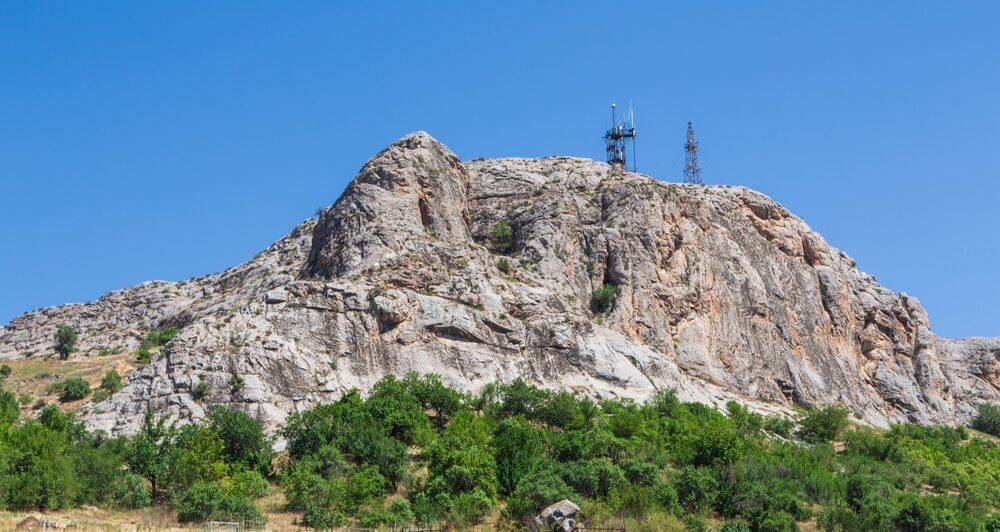
Mountains of Pakistan
Pakistan, situated in South Asia between Afghanistan and India, is one of the world’s most hilly nations. Most of Asia’s major mountain peaks and specific mountains may be found in Pakistan, the country with the most mountains. The highest peak in the nation is K2 (8,611 meters/28,251 feet) in the Karakoram.
The Himalayas contain the most famous mountain, Nanga Parbat (8,126 m/26,660 ft). Tirich Mir, another prominent peak in the Hindu Kush range (7,708 m/25,288 ft), is another well-known mountain. There are more than one hundred lesser ranges in Pakistan’s north besides these three big ones. However, the Balochistan Mountains in the same geographic region cover the country’s bulk. Pakistan has 8266 named mountains in total. Mountains in Pakistan are filled with natural resources.
The maximum range of mountains that Pakistan is blessed with draws geologists and rock climbers worldwide. More than a dozen peaks higher than 7,000 meters can be found in Pakistan. Four of the top 14 mountains on Earth are in Pakistan. The Karakoram range is home to the majority of these tallest summits. This blog will talk about some of Pakistan’s well-known mountains.
List of Top 7 Mountain Ranges in Pakistan
Karakoram
The Karakoram Range is a vast mountainous formation extending roughly 300 miles (500 km) southeast of Afghanistan’s eastern edge point along Central and South Asia drainage. The most significant high hills can be discovered there, along with the most prolonged ice beyond the higher elevations. The Hindu Kush towards the west, the Pamirs towards the northwestern, the Kunlun Mountains towards the north-eastern, and the Himalayas towards the south-eastern make up a series of mountain ranges in the middle of Asia that include the Karakorams.
This distant area has significant geopolitical significance because the frontiers of Tajikistan, China, Pakistan, Afghanistan, and India all meet within the Karakoram network. In early 19th-century English texts, the name “Kurra-koorrum,” a translation of the Turkish word meaning “Black Rock” or “Black Mountain,” first emerged.
The Karakorams are made up of several spur-studded adjacent ranges. A homogenous range only exists in the center. The system is roughly 150 miles (240 km) wide; if its easternmost outline Chang Chenmo and Pangong ranges of the Tibetan Plateau—is included, the width is expanded from 300 miles (500 km) to 500 miles (800 km).
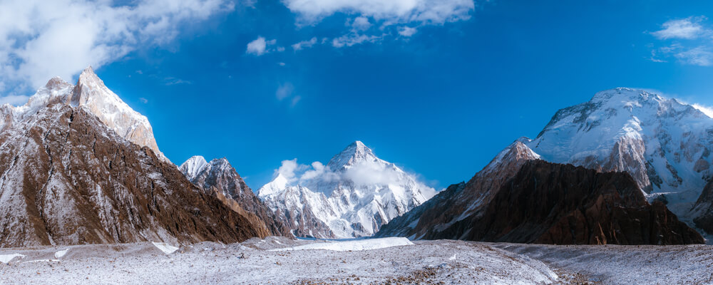
The area of the system is around 80,000 square miles (207,000 square km). Four peaks in the Karakoram Mountains rise higher than 26,000 feet (7,900 meters), with the highest being K2, or Mount Godwin Austen, which is the second-highest peak on the planet at 28,251 feet (8,611 meters) and has an average height of roughly 20,000 feet (6,100 meters).
Himalaya
The Himalayas, the tallest mountainous region in the world, adjoins Tibet to the south and the northern and southern borders of Pakistan, India, Nepal, Bhutan, and Burma, respectively. Ten of the fourteen 8000-meter mountains are found there, and because Nepal has the tallest peak and the most excellent mountaineering activity, it is most frequently associated with Nepal.
Despite the presence of Nanga Parbat, which hosted some of the most significant climbs in history, the western end of the range is comparatively obscure. The Himalayas in Pakistan’s western region comprise a tiny piece of the vast range, but it is just as majestic and beautiful as any other.
The Indus River, which has its source not far from the revered Kailash Mountain in Western Tibet, marks the actual western border of the Pakistani Himalayas, which is situated south and east of the river. The river reaches Pakistan from India and flows to Skardu in the northwest.
The Hunza River joins it further along this heading, south of Gilgit. From here, it begins to flow south and west until emerging onto the Indian plains from the foothills of the Himalayas. The Karakoram, which runs alongside the north, and the Himalayas are two very different mountain ranges.
A striking feature of the Pakistan Himalaya is how lush and fruitful it is in contrast to the barren Karakoram and Hindukush further north. Compared to the Karakoram Mountains, the Himalayas receives far more rainfall during the monsoon season, resulting in lush pine forests and green meadows reminiscent of Canada or Kyrgyzstan.
Hindu Kush
One of Central Asia’s major streams, the Hindu Kush, is a component of the massive Andes mountains that span Eurasia from east to west. It separates the Amu Darya (the ancient Oxus River) watershed north from the Indus River valley to the south and stretches from northeast to southwest.
The Hindu Kush continues southwest through Pakistan and into Afghanistan before combining into lesser mountains in western Afghanistan. To the east, it supports the Pamir range near the intersection of China, Pakistani-controlled Kashmir, and Afghanistan’s borders. Mount Tirich Mir, which rises to 25,230 feet close to the Pakistan-Afghanistan border, is the tallest peak (7,690 meters).
The Karambit Pass (14,250 feet [4,343 meters]) between the basins of the Konar (known as the Kunar or Chitral in Pakistan) and Gilgit rivers may be considered as the boundary, albeit it is difficult to pinpoint due to the regionally complex geography. The mountains in Afghanistan lose height and fan out into smaller ranges, making the western frontier similarly ambiguous. However, according to scientists, the Hindu Kush range goes far further west to the Iranian border.
Since the Hindu Kush divides one of Asia’s two main climate zones, the climate of the range exhibits significant diversity. Most of the eastern Hindu Kush and the Hindu Raj rise near the extreme western boundary of monsoonal Asia, and the mountains of Swat Kohistan are inside the rain-bearing summer monsoon winds’ range. Summers (from July to September) might be snowy or rainy, and winters can be dry in this area.
Safed Koh
From the volume of mountains that neglect Kabul on the southeast to the borders of India, Safed Koh (“white mountain”) is, in many ways, the most impressive range of mountain ranges on the northwestern frontier of Pakistan.
It extends like a 14,000-foot wall, plain and restrictive, standing tall above all hillsides. It maintains an attack that stretches more or less parallel to the surface to the borderline, which contrasts the typically written confirmation of border crest and canyon. Sitaram, the tallest peak in this remarkably straight-backed range, rises 15,620 feet above sea level, yet it is not very noticeable.
Geographically speaking, the Safed Koh is not a secluded range because the Kabul river, which flows from Dakka into the Peshawar plains, cuts a profound body of water across it. This is the only other interruption to the constant water divide that connects the Safed Koh with the extensive Shandur outgrowth of the Hindu Kush.
It is a significant geographical feature since it separates the valley of Kurram from the valley of the Kabul river and the Khyber road, making a path via its rough summit to link the two impractical. The same can be said of its northern giants, which descend through the Shinwari country towards Gandamak and Jalalabad, and its western flank, which adjoins the mountain plebs that influence the Kabul plain.
These slopes are picturesque and covered in forest, with deep glens cutting through them and daring jagged grooves. Here, the snow is late in fall, and there is plenty of moisture; vegetation is scarce on the southern, sunbaked rocks.
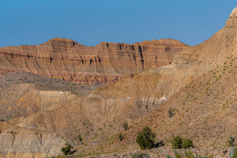
Sulaiman Mountains (Kōh-e Sulaymān)
The Sulaiman Range is a mountainous region in central Pakistan that divides Khyber Pakhtunkhwa, Punjab, and Balochistan. It stretches southward for roughly 280 miles (450 km) from the Gumal Pass to just north of Jacobabad. The highest peaks are known as Takht-i-Sulaiman, or Solomon’s Throne, located 30 miles (48 km) from the Gumal Pass.
According to legend, these peaks were Solomon’s throne during his visit to Hindustan. The higher of the two extremes, at 18,481 feet (5,633 meters), is the location of a ziarat (shrine) that attracts a lot of pilgrims each year. While the range’s western face lowers more gently, its eastern face drops abruptly to the Indus River.
Olives and juniper are abundant in the center and the north, while vegetation is limited in the south. The principal passes in the north are the Ghat, Zao, Chuhar Khel Dhana, and Sakhi Sarwar. The hill town of Fort Munro is located south of Dera Ghazi Khan and to the west (6,303 feet [1,921 meters]).
A natural barrier against the humid winds that blow from the Indian Ocean, generating arid conditions over Southern Afghanistan to the north, is formed by the Sulaiman Range and the high plain to the west and southwest. The Sulaiman Mountains are to the east and south of the relatively level, lesser Indus Delta. This gorgeous delta is primarily uninhabited wilderness and is subject to severe flooding.
Kirthar
The southern Pakistani hill region is known as the Kirthar Range. From the Mla River in east-central Balochistan to Cape Muri (Monze), west of Karachi on the Arabian Sea, it stretches southward for about 190 miles (300 km). Southern Balochistan and the Lower Indus Plain (east) are separated by the mountains (west). From 4,000 feet (1,200 m) in the south to about 8,000 feet (2,500 m) in the north, it comprises a succession of parallel rock hill ridges.
The Kolchi River drains it from the north, and the Hab and Lyri rivers, which empty into the Arabian Sea, do the same from the south. The region’s residents, primarily the Baloch, J, and Brahui tribes, live off sheep grazing.
From 4,000 feet (1,200 meters) in the south to over 8,000 feet (2,400 meters) in the north, it consists of a succession of parallel rock hill ridges. The Sindh segment of the mountains’ highest point was estimated to be 7,056 feet (2,151 meters) above the water level in April 2009. Camels can pass through a good number of the range’s passes. With the sharpest arcs towards the north and west and the gentlest dips toward the south and the valley of the Darhiyaro, Kirthar has a straightforward mountainous structure of the conventional synclinal type.
Most people living in the Kirthar Mountains are the Chhutto people of the Bhootani clan, the Sindhi people, and the Baloch people, who live off sheep feeding on both sides. The Chhutta, Burfat, Gabol, Marri, Bozdar, Lund, Nohani, Bugti, Chandio, Lashari, and other significant Baloch groups are found in Kirthar.
Salt Range
Between the valleys of the Indus and Jhelum rivers in Pakistan’s Punjab region is the Salt Range, a group of hills and low mountains. It gets its name from massive rock salt lakes that make up one of the most fantastic salt fields on the planet. they are Precambrian in age and can reach thicknesses of more than 1,600 feet (490 m).
The range measures around 186 miles (300 km) from east to west, and its center and eastern portions are between 5 and 19 miles wide. It has an average height of 2,200 feet and 4,992 feet at Sakesar Mountain (1,522 m). The Salt Fulfills the requirement of coal, gypsum, and other minerals in contrast to the salt deposits that have been mined since antiquity.
The landform resembles a group of low mountains, the top strata of which have been eroded. It is located southwest of Rawalpindi and is made up of two asymmetrical, parallel hills that are split by a longitudinal valley. It is the southern terrace of the Potwar Plateau (1,700 feet). Both ridges have skewing northern slopes and steep southern slopes.
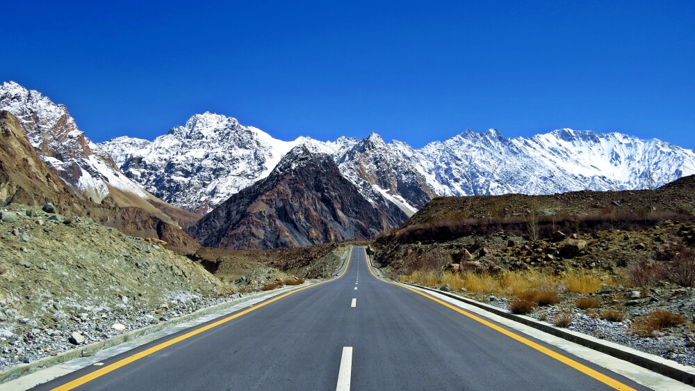
Mountain Tourism in Pakistan
This abundance of fanged mountains transforms Pakistan into a significant tourist hotspot, providing fantastic chances for climbing, trekking, and other mountain-related outdoor adventures. The region is accurately described as a mountaineers’, adventurers’, and environment lovers’ paradise. Every year, a sizable number of hikers from all over the world are drawn to the Northern Areas of Pakistan by the alluring allure of this high, rugged, limitless sea of rough granite and icy dihydrogen monoxide pinnacles.
Despite the country’s present climate, the tourism destination is still expanding in Pakistan and, ideally, will soon physically approach Welkin Heights. The Pakistani government has taken various steps to protect foreign tourists by offering individual and group special police guards in the area as needed. The state has concluded that alpine tourism can be a critical factor in eradicating poverty in these rough mountains of the nation. The Pakistani Ministry of Tourism works hard to promote mountain travel in northern regions.
The center of the mountain range chains on Earth is located in Pakistan. the Pamir, Hindu-Kush, Himalaya, and Karakoram. Within 180 kilometers, there are approximately 100 peaks higher than 7,000 meters (23,300 ft). The numbers are astounding. The Karakoram contains the second-highest mountain on Earth, the K2, at 8,611 meters. Pakistan is home to five of the fourteen (14) 8,000-meter peaks in the world. Numerous mountains above 3,000 to 6,000 meters exist but have not been climbed or given names. More than 50 of the top 100 peaks on the planet are in Pakistan.
Which Mountain Range Forms the Border between China and Pakistan?
The Karakoram is a mountainous region in Kashmir that runs along the frontiers of Pakistan, China, and India. It also reaches Afghanistan and Tajikistan at the range’s northwest corner.
Which is the Highest Mountain in Pakistan?
Nanga Parbat, also known as Diamir, is one of the tallest mountains in the world, standing at 26,660 feet (8,126 meters), and is located in the western Himalayas 17 miles (27 km) west-southwest of Astor, in the portion of Kashmir that Pakistan administers.
Interesting Facts about Mountains in Pakistan:
Pakistan is home to some of the world’s tallest mountains. The second-tallest mountain in the world is located there. It goes by several names, including Dapsang or Chogori in local parlance, Mount Godwin-Austen in English, and Qogir Fengin in Chinese. But most people call it K2, which is 8,611 meters (28,251 ft) tall.
The second-highest mountain in the world is K2, also known as Godwin Austin, and is located in Pakistan. It is a section of the Karakoram, or Greater Himalayas, which extends into China and India. The Hindu Kush Mountains in Pakistan are the second tallest mountains in the world, behind the Trich Mir. As a result, it is a significant but difficult decision for extreme climbing and snow sports experts to go, thanks to the three highest peaks, the Himalayas, the Greater Himalayas, or Pakistan’s Karakoram and the Hindu Kush ranges.
FAQS
What type of mountain is Mount Everest?
During the Cenozoic collision of the Indian Plate with the Asian Plate, sedimentary and metamorphic rocks that make up Mount Everest were faulted southward over a continental crust of Archean granulites.
Are the Karakoram mountains part of the Himalayas?
Pakistan, India, and China share a border with the Karakoram mountain range. It is a part of the more extensive Himalayan mountain range, which includes Mount Everest, the tallest mountain on Earth. K2 is the Karakoram range’s most towering sum.
Where is Rakaposhi mountain located?
A mountain in Pakistan’s Karakorum mountain range is named Rakaposhi. It is located in the Nagar Valley, in the Gilgit District of Pakistan’s Gilgit-Baltistan region, some 100 kilometers north of the city of Gilgit. Rakaposhi is an indigenous word that means “Snow Covered.”
Which river originates from the Sulaiman range?
The Gomal River empties into the Indus River to the east, and the Dori River and other minor tributaries of the Arghandab River empty into the Helmand River to the southwest are among the rivers that emerge from the Sulaiman range.
For which activities are the tourists attracted to the mountains?
Mountain destinations draw visitors for various reasons, such as the mild climate, clean air, distinctive landscapes and fauna, natural beauty, local culture, history, and heritage, and the chance to experience snow and engage in winter sports.